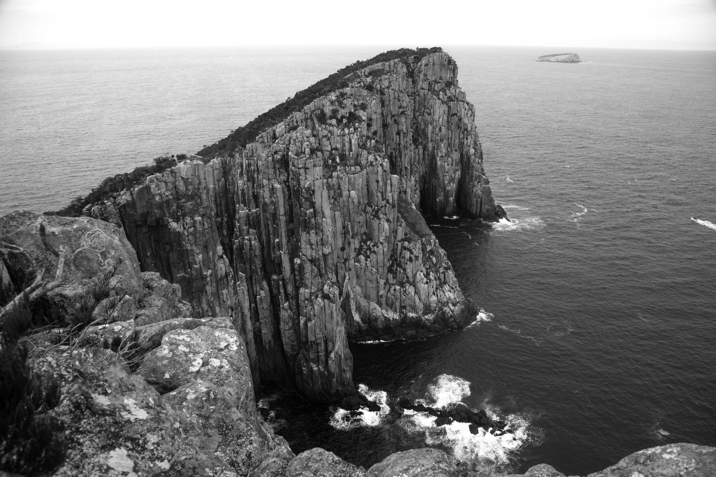
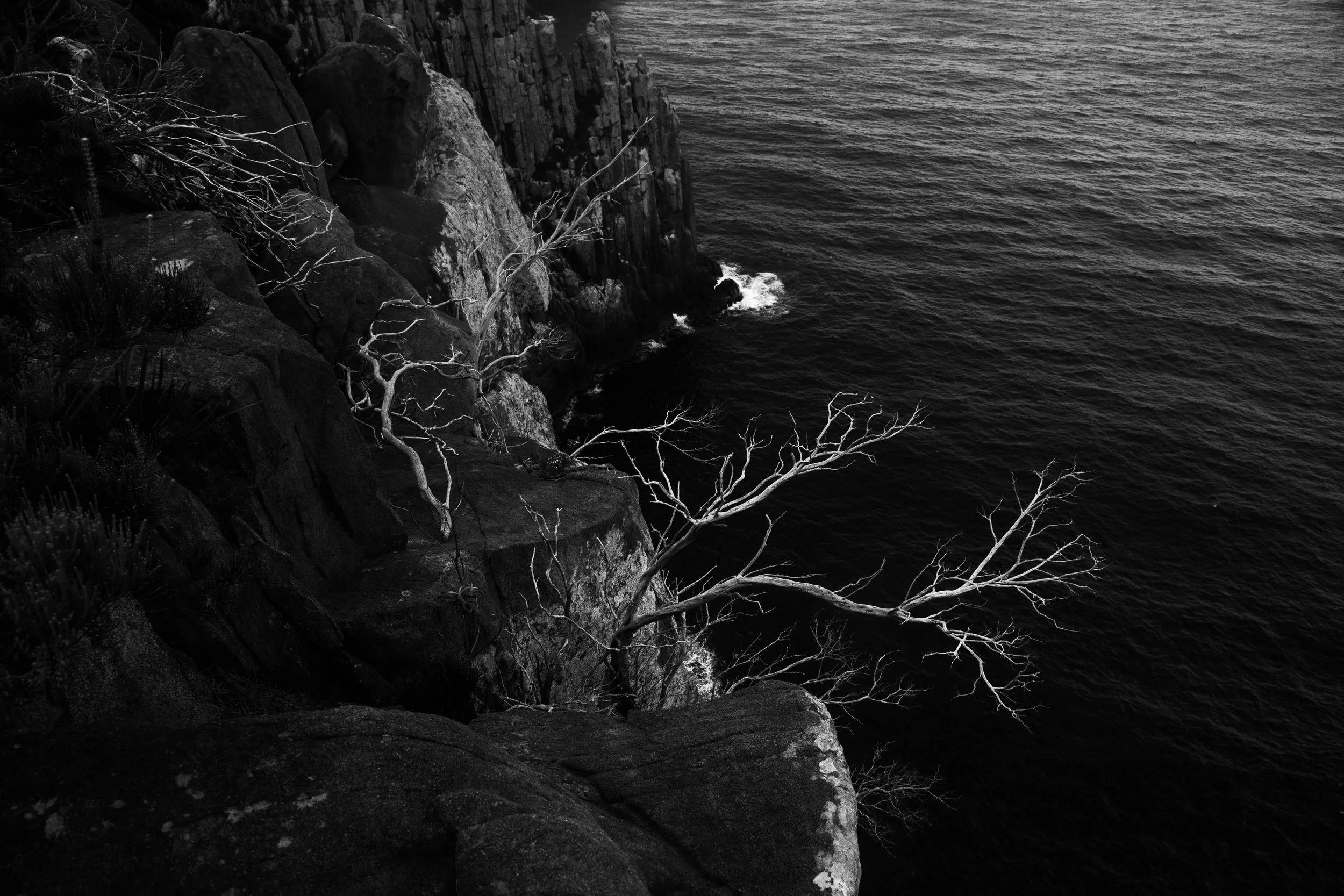
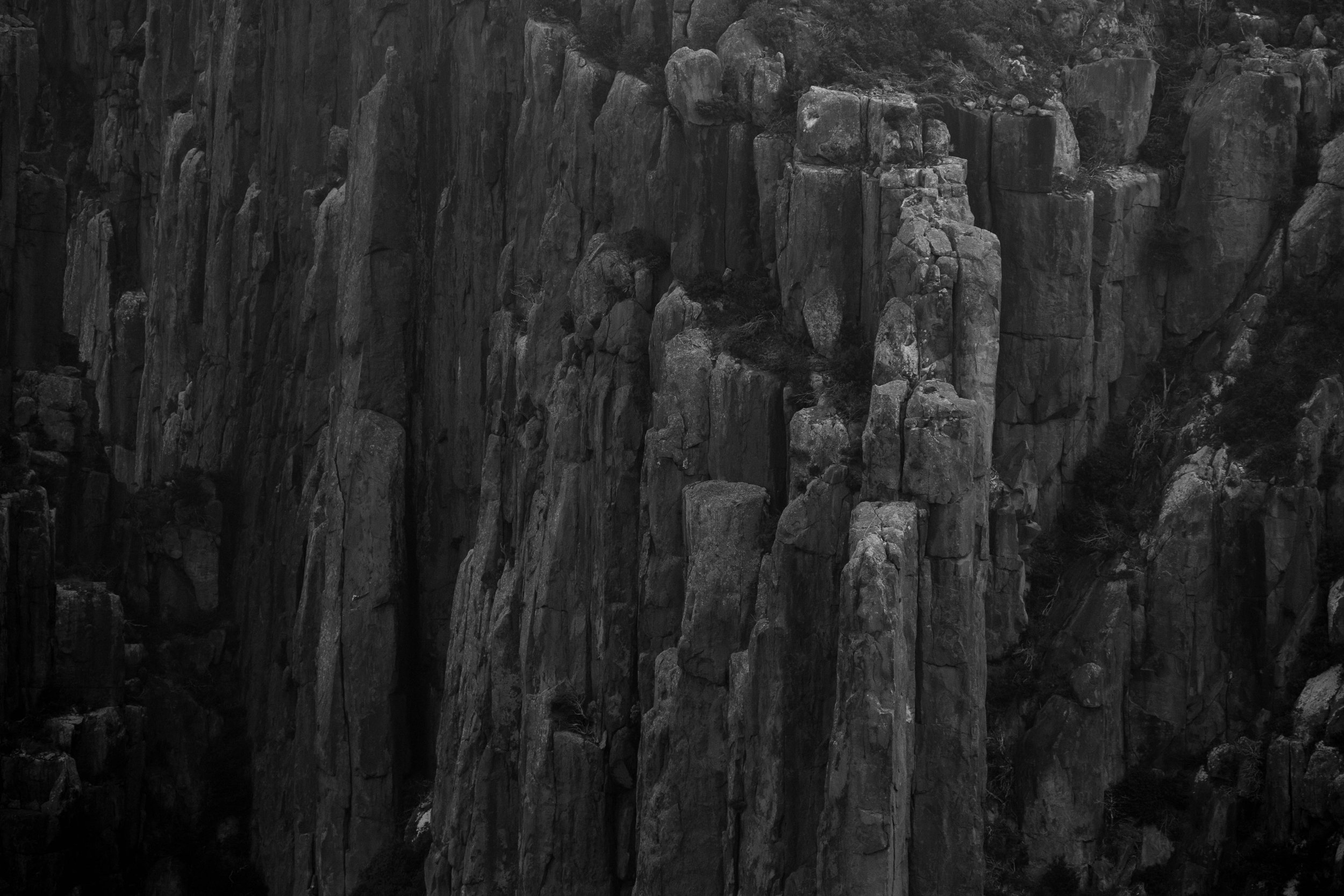
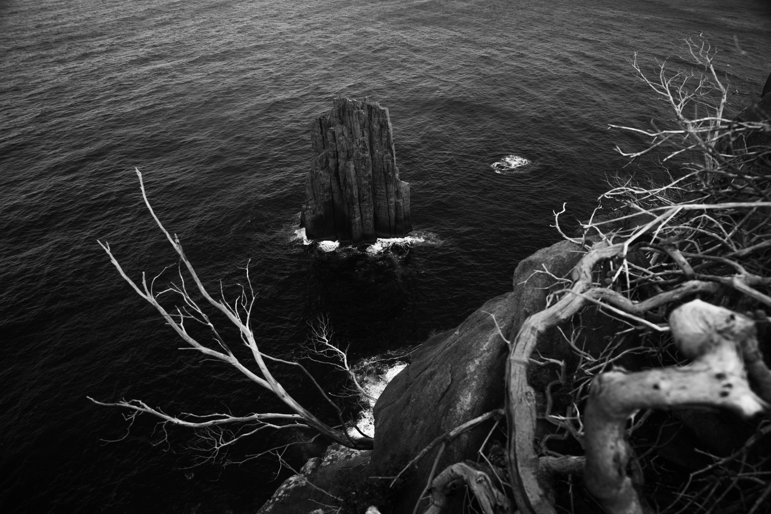
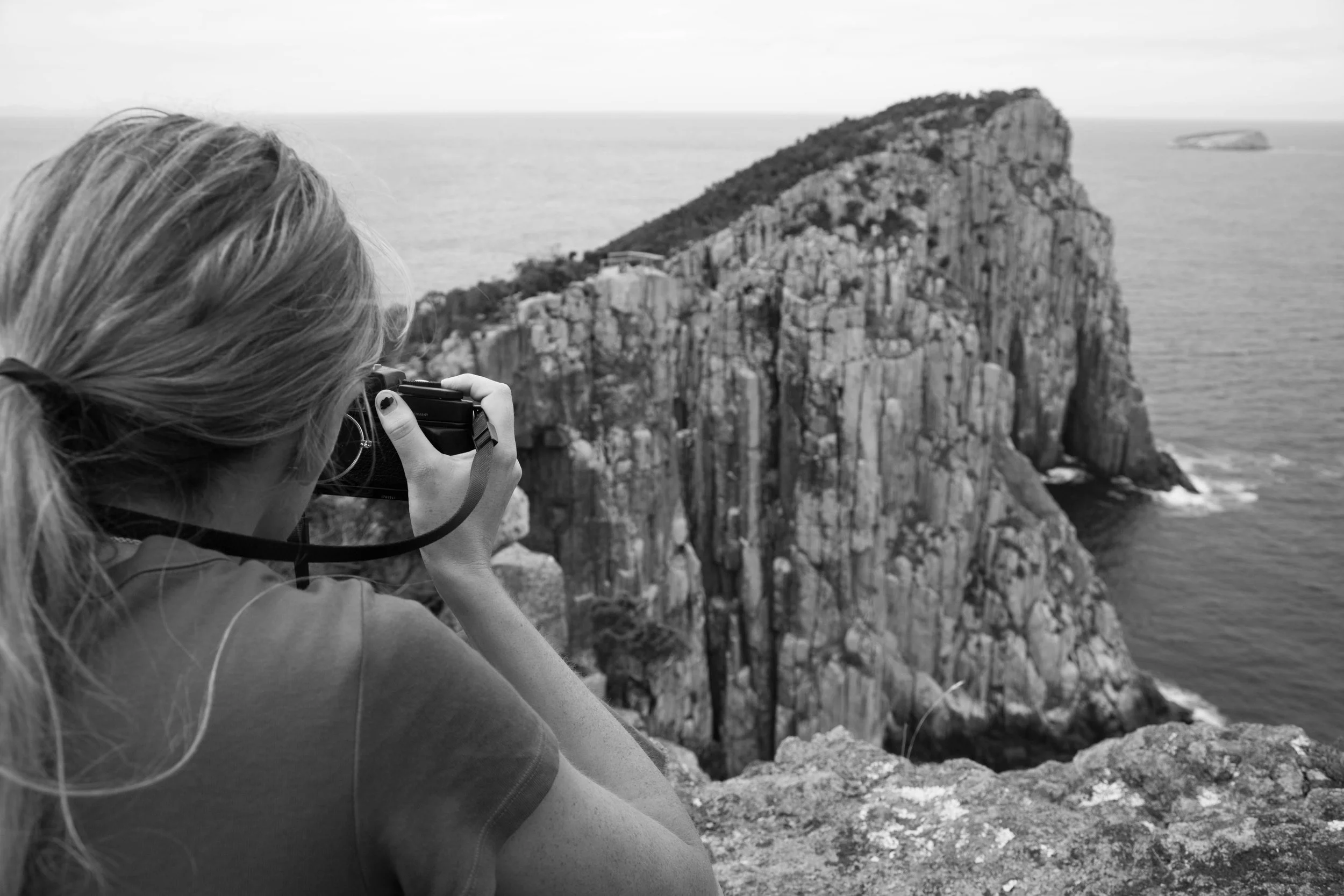
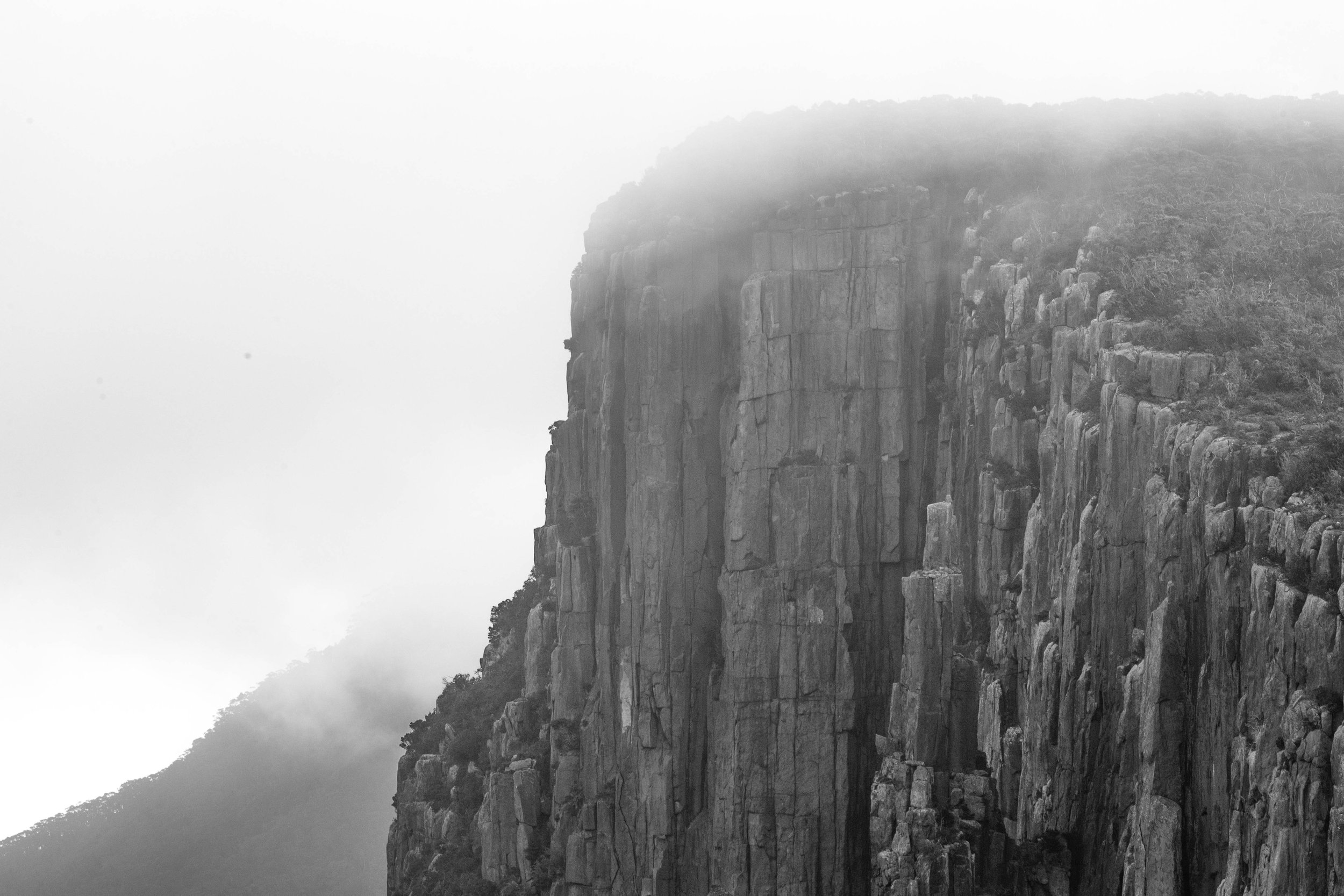
Cape Hauy

A stunning there and back walk to some awe-inspiring cliffs. The track, part of the Three Capes Track, first undulates through woodlands and heath containing an abundance of wildflowers. It then drops down a steep set of mostly stone steps, before ascending again towards the cape. Cape Hauy juts out into the restless ocean, with views on both sides. The cape itself has spectacular dolerite columns that plunge directly into the sea. Keep an eye out for seabirds, eagles and even passing whales: camera and binoculars recommended.


Getting There
Tasman National Park is located in the south-eastern corner of Tasmania. It's a 90-minute drive on sealed roads from Hobart via Sorell on the A3, and then the A9 (Arthur Highway) toward Port Arthur. The park straddles both the Tasman and Forestier peninsulas, however most of its accessible features are on the Tasman Peninsula.
To reach Fortescue Bay from Eaglehawk Neck, continue along the A9 towards Port Arthur until you reach the junction with C344. Follow the C344 until you reach Fortescue Bay. This is a 12km drive along an unsealed road but is suitable for 2WD vehicles and mountain bikes. Beware of towing vehicles, delivery trucks and tour buses. Keep to the left of the road particularly on blind corners.
Access to the south-western part of the park is also via the Arthur Highway (A9), then following Safety Cove Rd at Port Arthur township to access Remarkable Cave and walking tracks to Maingon Blowhole, Mount Brown and Crescent Bay. Further west, on the road to Nubeena, the access to the Cape Raoul Great Short Walk, Shipstern Bluff and Tunnel Bay leave the Arthur Highway at Highcroft Road, which turns into Stormlea Road.
Where possible, please avoid driving in our reserves at night. You are sharing the roads with our native wildlife, so take it slow and watch out for animals on the road.
